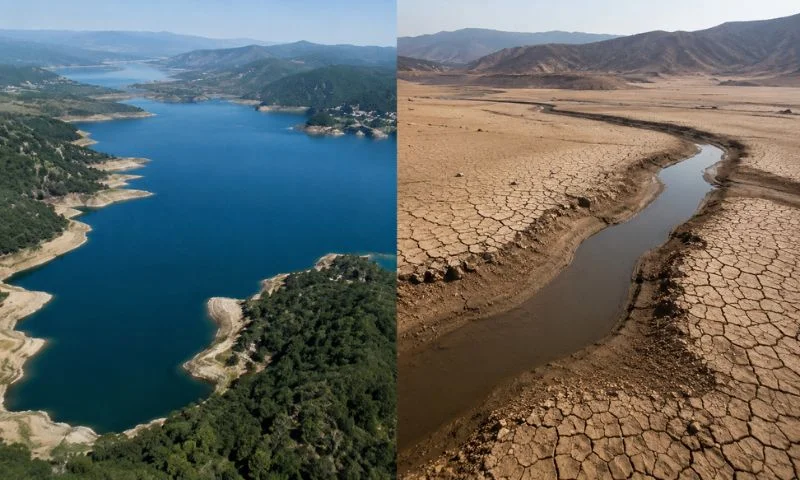
The world is losing freshwater at an alarming pace as climate change, prolonged droughts and unsustainable water use place growing pressure on rivers, lakes and wetlands.
According to a 2025 World Bank report cited by Al Jazeera, the planet loses an estimated 324 trillion litres of freshwater every year. That amount is enough to meet the annual needs of about 280 million people.
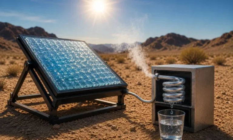
Read More: Scientists Create Solar Device That Turns Desert Air Into Drinking Water
The phenomenon, known as “continental drying”, has become a growing concern for scientists and policymakers. To mark the World Day to Combat Desertification and Drought on June 17, Al Jazeera examined satellite imagery showing how water bodies across the globe have shrunk over recent decades.
Parana River, Argentina
The Parana River stretches nearly 4,900 kilometres and serves as a vital trade route connecting Brazil, Paraguay and Argentina.
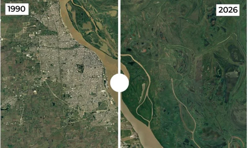
Satellite images comparing 1990 and 2026 show a sharp decline in water levels near Rosario. The reduction has disrupted grain exports, lowered hydroelectric output at the Itaipu Dam and exposed large areas of riverbed.
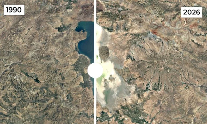
Lake Poope, Bolivia
Lake Poope once ranked as Bolivia’s second-largest lake, covering around 1,000 square kilometres.
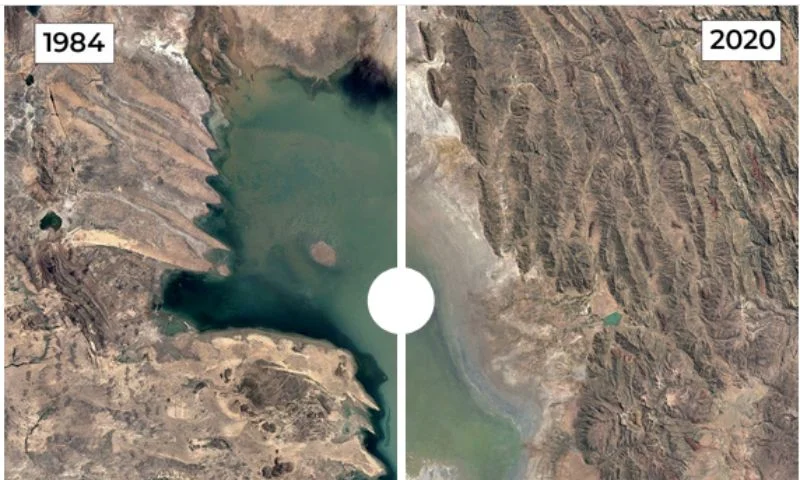
Satellite imagery from 1984 and 2020 shows that the lake has almost completely disappeared. Drought, rising temperatures and water diversions transformed much of the area into a salt flat, devastating fisheries and Indigenous Uru communities.
Lake Ngami, Botswana
Located on the edge of the Okavango Delta, Lake Ngami depends heavily on seasonal inflows.
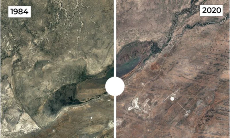
Images from 1984 and 2020 reveal dramatic fluctuations. Severe droughts and declining water inflows nearly erased the lake at its lowest point, damaging fishing grounds and livestock pastures before partial recovery occurred.
Laguna de Aculeo, Chile
Laguna de Aculeo, near Santiago, was once a popular recreational destination.
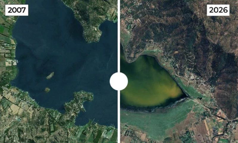
Satellite comparisons between 2007 and 2026 show that the lake has largely dried up. Years of drought and increasing water stress have dramatically altered the landscape and affected nearby communities.
Lake Urmia, Iran
Lake Urmia was once the Middle East’s largest saltwater lake, spanning nearly 6,000 square kilometres during the 1990s.
Today, it covers only about 581 square kilometres. Consecutive droughts, river diversion projects, agricultural demand and groundwater extraction have reduced the lake to less than 10 percent of its former size.
Al Chibayish Marshes, Iraq
The Al Chibayish Marshes form part of Iraq’s UNESCO-listed Mesopotamian Wetlands.
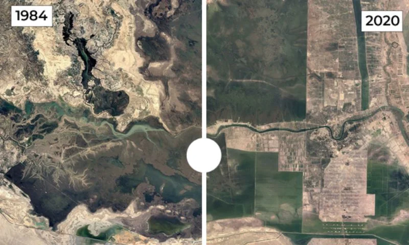
Satellite imagery from 1984 and 2020 highlights extensive drying caused by drainage projects and drought. However, increased rainfall and restoration efforts have helped some parts of the marshes recover in recent years.
Ambovombe, Madagascar
Southern Madagascar has endured some of the country’s harshest drought conditions.
Images comparing 1985 and 2020 show worsening environmental degradation around Ambovombe. Water shortages, stronger sandstorms and declining agricultural productivity have increased hardship for local communities.
Lake Faguibine, Mali
Near the Sahara Desert, Lake Faguibine has suffered decades of decline.
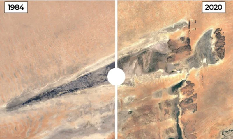
Satellite images show that reduced flooding from the Niger River, combined with sediment buildup and drought, has caused the lake to shrink dramatically and accelerated desertification across the region.
Lake Mead, United States
Lake Mead, located on the Nevada-Arizona border, is the largest reservoir in the United States by capacity.\
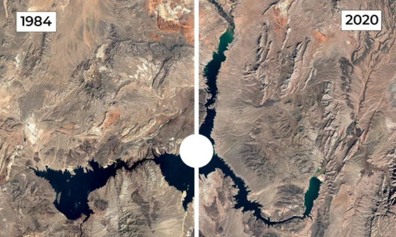
Satellite imagery from 1984 and 2020 reveals a dramatic fall in water levels. Prolonged drought, rising temperatures and heavy water consumption have exposed vast stretches of previously submerged land.
South Aral Sea, Uzbekistan
The South Aral Sea remains one of the world’s most severe environmental disasters.
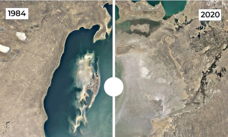
Decades of river diversions for irrigation have shrunk the lake by more than 90 percent. Satellite images from 1984 and 2020 show vast expanses of exposed lakebed where water once existed.
Scientists warn that continued freshwater losses could threaten food production, biodiversity, energy generation and water security for millions of people. The satellite images highlighted by Al Jazeera provide a stark reminder of how rapidly landscapes can change when water resources come under sustained pressure.